


Mapping the World A History of the Directorate of Overseas Surveys 1946-1985
- Collection : Prof Jim Green
- Publisher : HMSO
- Published In : London
- Illustrations : 8 col maps, 32 b/w photos, map endpapers
Description:
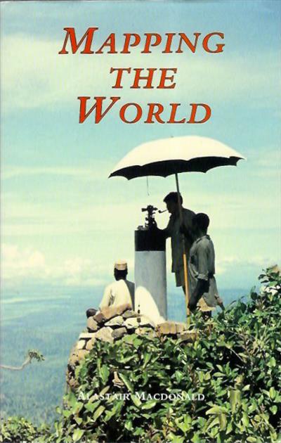
The Directorate of Overseas Surveys was founded by the Colonial Office in 1946, its brief was to provide national geodetic frameworks throughout the British Empire which would not only contribute to our knowledge of our planet but also allow for easy mapping, and to advance the usage of emergent technologies in mapping such as ariel photography. This is a social history of the department reflecting the desires of those who worked for the department to help others through means of mapping, and covers their operations in some 55 countries around the globe.
Condition
Vg in d/w.
Other titles from the collection : Prof Jim Green
Click to view all titles in this collection...


![Ethiopia [Under-Water Paradise]: A Bird's-eye-view for the Tourist - Un aperçu pour le touriste](/ProductImage.aspx?File=34231.jpg&Size=60)
Ethiopia [Under-Water Paradise]: A Bird's-eye-view for the Tourist - Un aperçu
Jaubert, J.; Petron, C. (Photos)
Price £35.00

A Birders guide to Costa Rica An Introduction to Bird Finding; A Self-Made Tour
Taylor, K.
Price £15.00

You may also like...


The Entomological Publications of Pierre Milliere (1811-1887)
Sattler, K.; Tremewan, W.G.
Price £12.00


